Day 4: Mt Perry to Biggenden
There must be something in the water at Mt Perry. This morning we were enjoying the sun and breakfast at the local store, when another talkative local joined us for a chat. He was resplendent in cowboy clothes and a silver cowboy buckle on his belt. Turns out the eighty year old earned a living as a professional rodeo rider back in the day before he was a drover and then turned to the dark side and worked in the mines.
We left the town knowing there would be no huge hills or big winds to mar our day. Just a nice 76 km jaunt to the end. Nobody mentioned the gravel road, until it was too late. Ray did have a throw away line about a big hill, but it was on a google map road, so I didn't believe him.
We stopped at Mingo Crossing where there is a lovely camping ground, which included such luxuries as tables and benches, and the first toilet we have seen between destinations. The green door has been our only option. Two motorcyclists pulled up, and we asked if we could swap bikes, but they weren't too keen. Luckily the camp manager was available to ask advice about the big hill and how to avoid it. I'm pretty sure that google maps just made up the bit about a road through it. We did have to travel a few more kms, but it was sure worth it for peace of mind.
We stopped for a drink of water near a clearly sign-posted intersection, when a local drove up and asked where we were heading. We told him and helpfully he directed us in the same direction as the large sign. I think he belongs in the same map reading school as Ray. Finally we made it back to Biggenden.
305kms later, with too many hills to whinge about. We survived another bicycle trip without the map reader being killed by the hill hater.

We were just about to ride out of town and a random lady who we exchanged pleasantries with, said: " Oh, the gravel road into Biggenden...". So we eventually get onto the gravel road (it wasn't good) and I am thinking "We've got this for the next 30ks - noooooooo". Then a miracle - blacktop! A beautiful two lane road which all of a sudden turned to gravel again, although this time not so bad. Next thing you know....

We arrive at Mingo Crossing, as good as it was unexpected. These huts in the background are under construction and appear to glamping huts. Apparently they should be ready for Christmas.

There are also some powered van sites. The two motor cyclists would not swap vehicles with us.

Plenty of room for a picnic (picnic huts not pictured) and some water sports in the river

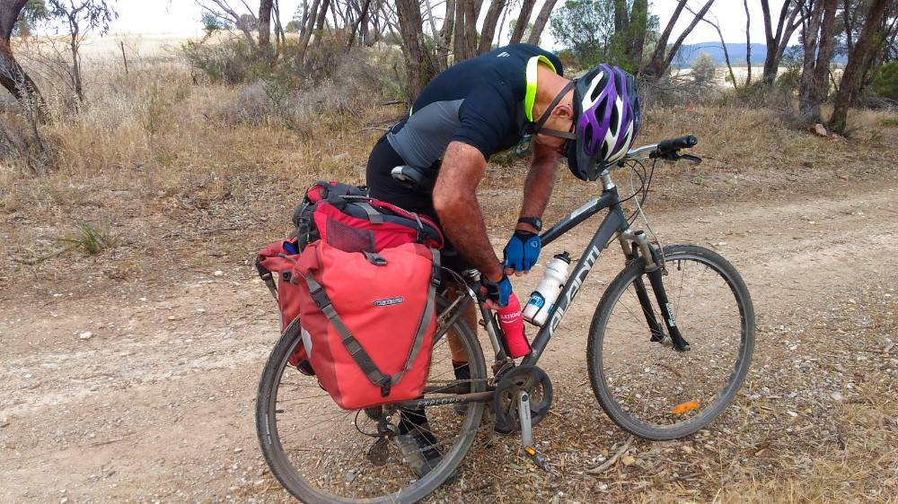
Stopped again. We must have been at the top of a Big Hill. This may have been at the top of the Deep Creek ravine, a low point on the road from Gooroolba to Biggenden.

We will have to go Paradise Dam and the Chowey Bridge some day. You might recall Gooroolba (War Memorial) and Didcot? Around 20 houses some of which seem occupied. Coringa and Mt Appalan - no idea.

Waiting for the cameraman after talking to a local in front of the (above) signs.
I have taken the sad decision to retire the Avanti Explorer from exploring. Hauling 80kg of rider along with 25 - 30kg of travelling essentials, not always on smooth surfaces, has taken its toll to the extent that I can start to feel a little more frame flexion than I feel comfortable with. A lot of damage can be done travelling at 60 klm/hr downhill should something break. But dont be too sad, as it will still be seen on the roads and bike paths of Hervey Bay on leisurely rides down to Enzo's. I am sure we will add to the current 30,000 klms + travelled over the next few years. I definitely got more than $700 in enjoyment from all we've experienced on the bike.
Ride Notes
- I thought this road would be quite a major road, but instead it turned out to be one of the quieter roads, partially gravel
- There were two gravel sections, at roughly 12k - 22k and 25k - 28k. The first section is quite rough with quite a few corrogations, but the second section was better.
- Our Google map had us going over Mt Steadman and into Didcot, but we did not see the road as it probably does not exist.
- Instead we rode on to Gooroolba (almost), then turned left towards Didcot. This probably added around 4klm to our journey, but the hill we went over to get to Didcot was probably reduced in size compared to the original route
- As you could see in the pics above, the Mingo crossing was something of an oasis where you could sit and have some lunch and go to the toilet if necessary. It was 30k into the ride
- As you could see from the time of the journey (4.5hrs riding), it was much quicker than other days.